
Thank you for supporting this site ❤️
Make a donation
Make a donation
Gear up for your next adventure:
As an Amazon Associate, this site earns from qualifying purchases at no extra cost to you.
Unity topographic map
Click on the map to display elevation.
Thank you for supporting this site ❤️
Make a donation
Make a donation
Gear up for your next adventure:
As an Amazon Associate, this site earns from qualifying purchases at no extra cost to you.
About this map
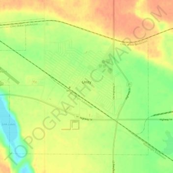
Name: Unity topographic map, elevation, terrain.
Location: Unity, Division No. 13, Saskatchewan, S0K 4L0, Canada (52.42746 -109.19347 52.45630 -109.13357)
Average elevation: 640 m
Minimum elevation: 615 m
Maximum elevation: 656 m
Division No. 13 trails, hiking, mountain biking, running and outdoor activities
Thank you for supporting this site ❤️
Make a donation
Make a donation
Gear up for your next adventure:
As an Amazon Associate, this site earns from qualifying purchases at no extra cost to you.