Geolocate

Sankoo topographic map

Click on the map to display elevation.

About this map

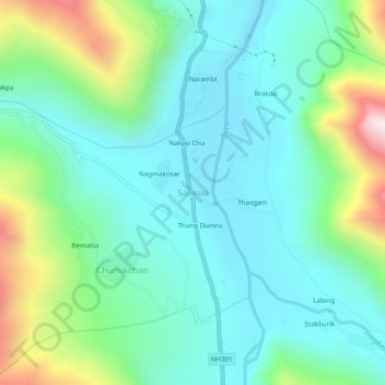
Name: Sankoo topographic map, elevation, terrain.

Location: Sankoo, Sankoo tehsil, Kargil district, Ladakh, India (34.26968 75.94222 34.30968 75.98222)

Average elevation: 3,149 m

Minimum elevation: 2,932 m

Maximum elevation: 3,799 m

Gear up for your next adventure:

🧰Multitool Knife - Compact and versatile tool for outdoor use
🔥Camping Stove - Portable stoves to cook outdoors with ease
🧥Waterproof Pants - Keep dry during rainy hiking conditions
🛶Canoe Life Vest - Safety vest for water sports
🎒Hiking Daypack - Lightweight and durable backpacks for day trips and excursions

As an Amazon Associate, this site earns from qualifying purchases at no extra cost to you.