
Thank you for supporting this site ❤️
Make a donation
Make a donation
Gear up for your next adventure:
As an Amazon Associate, this site earns from qualifying purchases at no extra cost to you.
Lesage topographic map
Click on the map to display elevation.
Thank you for supporting this site ❤️
Make a donation
Make a donation
Gear up for your next adventure:
As an Amazon Associate, this site earns from qualifying purchases at no extra cost to you.
About this map
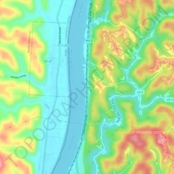
Name: Lesage topographic map, elevation, terrain.
Location: Lesage, Cabell County, West Virginia, 25537, United States (38.48647 -82.31848 38.52647 -82.27848)
Average elevation: 210 m
Minimum elevation: 159 m
Maximum elevation: 295 m
Thank you for supporting this site ❤️
Make a donation
Make a donation
Gear up for your next adventure:
As an Amazon Associate, this site earns from qualifying purchases at no extra cost to you.
Other topographic maps
Click on a map to view its topography, its elevation and its terrain.
Pea Ridge
United States > West Virginia > Cabell County > Barboursville > Tallwood Acres
Average elevation: 197 m