
Thank you for supporting this site ❤️
Make a donation
Make a donation
Gear up for your next adventure:
As an Amazon Associate, this site earns from qualifying purchases at no extra cost to you.
Cotelo topographic map
Click on the map to display elevation.
Thank you for supporting this site ❤️
Make a donation
Make a donation
Gear up for your next adventure:
As an Amazon Associate, this site earns from qualifying purchases at no extra cost to you.
About this map
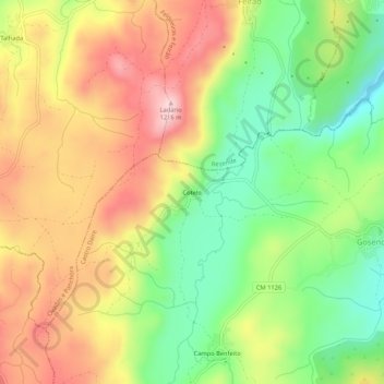
Name: Cotelo topographic map, elevation, terrain.
Location: Cotelo, Gosende, Castro Daire, Viseu, Portugal (40.99349 -7.95093 41.03349 -7.91093)
Average elevation: 1,059 m
Minimum elevation: 917 m
Maximum elevation: 1,210 m
Thank you for supporting this site ❤️
Make a donation
Make a donation
Gear up for your next adventure:
As an Amazon Associate, this site earns from qualifying purchases at no extra cost to you.