Geolocate

Rota topographic map

Click on the map to display elevation.

About this map
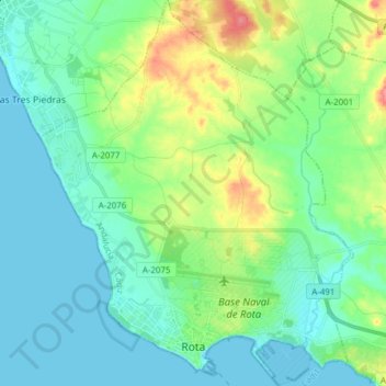
Name: Rota topographic map, elevation, terrain.

Location: Rota, Northwest Coast, Cádiz, Andalusia, 11520, Spain (36.61037 -6.42118 36.73351 -6.29615)

Average elevation: 18 m

Minimum elevation: -2 m

Maximum elevation: 71 m

Other topographic maps

Click on a map to view its topography, its elevation and its terrain.

Cerro Colón

Spain > Andalusia > Northwest Coast > Chipiona

Average elevation: 27 m

Gear up for your next adventure:

🔭Compact Monocular - One-handed bird watching and trail spotting
🛶Kayak Dry Bag - Waterproof storage for kayaking adventures
🧥Insulated Jacket - Keep warm in cold outdoor conditions
🥾Mountain Hiking Boots - High-traction boots for rocky terrain
🧣Merino Neck Gaiter - Protects against wind, sun, and cold at high altitudes

As an Amazon Associate, this site earns from qualifying purchases at no extra cost to you.