Geolocate

Cogon topographic map

Click on the map to display elevation.

About this map

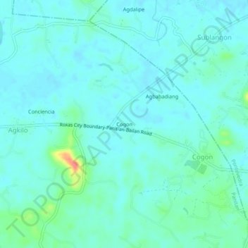
Name: Cogon topographic map, elevation, terrain.

Location: Cogon, Panitan, Capiz, Western Visayas, 5815, Philippines (11.44410 122.78300 11.48410 122.82300)

Average elevation: 14 m

Minimum elevation: 3 m

Maximum elevation: 69 m

Gear up for your next adventure:

🧭GPS Handheld Device - Reliable GPS navigation for outdoor adventures
🧦Hiking Liner Socks - Thin base layer to prevent friction and blisters
Camping Coffee Maker - Brew fresh coffee anywhere on the topographic map
🛏️Sleeping Bag - Warm and compact sleeping bags for outdoor camping
🧥Waterproof Pants - Keep dry during rainy hiking conditions

As an Amazon Associate, this site earns from qualifying purchases at no extra cost to you.