Geolocate

Payande topographic map

Click on the map to display elevation.

About this map

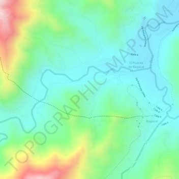
Name: Payande topographic map, elevation, terrain.

Location: Payande, Villeta, Gualivá, RAP (Especial) Central, Colombia (4.97754 -74.50586 4.99754 -74.48586)

Average elevation: 912 m

Minimum elevation: 799 m

Maximum elevation: 1,181 m

Gear up for your next adventure:

🥾Trail Hiking Socks - Comfortable socks to prevent blisters and fatigue
🔭Compact Binoculars - Lightweight optics for scouting trails and wildlife
🥾Trail Running Shoes - Lightweight and durable shoes for trail running
🧭GPS Handheld Device - Reliable GPS navigation for outdoor adventures
🕶️Polarized Sunglasses - Reduces glare from snow and water at high elevations

As an Amazon Associate, this site earns from qualifying purchases at no extra cost to you.