
Puzzle Lake Provincial Park topographic map
Interactive map
Click on the map to display elevation.
About this map
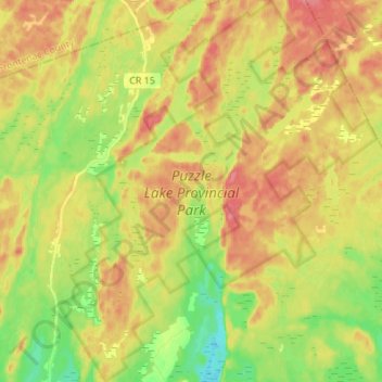
Name: Puzzle Lake Provincial Park topographic map, elevation, terrain.
Average elevation: 196 m
Minimum elevation: 159 m
Maximum elevation: 229 m
Routes: Lennox and Addington County GPS tracks, routes, trails, hikes
Other topographic maps
Click on a map to view its topography, its elevation and its terrain.
Lions Beaver Lake Park
Canada > Ontario > Lennox and Addington County > Stone Mills > Erinsville
Average elevation: 172 m