
Mera topographic map
Interactive map
Click on the map to display elevation.
About this map
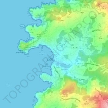
Name: Mera topographic map, elevation, terrain.
Location: Mera, Oleiros, La Coruña, Galicia, 15177, España (43.35950 -8.35751 43.39950 -8.31751)
Average elevation: 33 m
Minimum elevation: 0 m
Maximum elevation: 149 m
Other topographic maps
Click on a map to view its topography, its elevation and its terrain.