
Cerro de las Cuentas topographic map
Interactive map
Click on the map to display elevation.
About this map
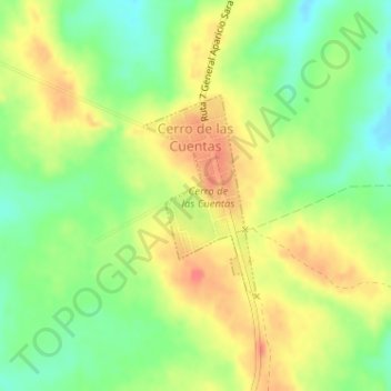
Name: Cerro de las Cuentas topographic map, elevation, terrain.
Location: Cerro de las Cuentas, Cerro Largo, 36200, Uruguay (-32.63117 -54.59811 -32.61724 -54.58881)
Average elevation: 207 m
Minimum elevation: 180 m
Maximum elevation: 233 m
Other topographic maps
Click on a map to view its topography, its elevation and its terrain.
Plazoleta Gral. Artigas
Uruguay > Cerro Largo > Río Branco
Plazoleta Gral. Artigas, Olimar I, Río Branco, Cerro Largo, 37100, Uruguay
Average elevation: 11 m
Centurión
Uruguay > Cerro Largo > Centurión
Centurión, Cerro Largo, 37000, Uruguay
Average elevation: 149 m