Geolocate

Carballo topographic map

Click on the map to display elevation.

About this map

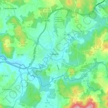
Name: Carballo topographic map, elevation, terrain.

Location: Carballo, Bergantiños, A Coruña, Galicia, 15102, Spain (43.17341 -8.72913 43.25341 -8.64913)

Average elevation: 144 m

Minimum elevation: 88 m

Maximum elevation: 319 m

Gear up for your next adventure:

🛶Waterproof Dry Bags - Keep electronics and clothes dry during river crossings
🥽Outdoor Goggles - Protective eyewear for outdoor activities
🧥Softshell Jacket - Windproof and breathable jacket for hiking
🧤Thermal Hiking Gloves - Grip-enhanced gloves for cold-weather altitude trekking
🍽️Titanium Camping Spork - Ultralight and indestructible eating utensil

As an Amazon Associate, this site earns from qualifying purchases at no extra cost to you.