Geolocate

Lejunior topographic map

Click on the map to display elevation.

About this map

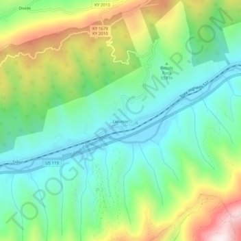
Name: Lejunior topographic map, elevation, terrain.

Location: Lejunior, Harlan County, Kentucky, 40865, United States (36.89721 -83.21278 36.93721 -83.17278)

Average elevation: 585 m

Minimum elevation: 379 m

Maximum elevation: 1,006 m

Other topographic maps

Click on a map to view its topography, its elevation and its terrain.

Pine Mountain

United States > Kentucky > Harlan County

Average elevation: 536 m

Gear up for your next adventure:

Lightweight Backpacking Tent - Compact tent for efficient hiking trips
🐕Hiking Dog Pack - Let your canine companion carry their own water and food
🛌Insulated Sleeping Pad - Critical thermal barrier between you and the cold ground
🔋Emergency Crank Radio - Weather alerts and power without needing batteries
Camping Groundsheet - Protect your tent from moisture and dirt

As an Amazon Associate, this site earns from qualifying purchases at no extra cost to you.