Geolocate

Battice topographic map

Click on the map to display elevation.

About this map

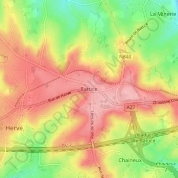
Name: Battice topographic map, elevation, terrain.

Location: Battice, Herve, Verviers, Liège, Wallonia, 4650, Belgium (50.62794 5.79964 50.66794 5.83964)

Average elevation: 278 m

Minimum elevation: 207 m

Maximum elevation: 335 m

Gear up for your next adventure:

🧢Sun Protection Cap - Breathable cap to protect from sun exposure
🔋Solar Power Bank - Keep your GPS and devices charged during long outdoor trips
🧦Outdoor Socks - Durable socks designed for hiking and outdoor sports
🥘Camping Cookware Set - Compact nesting pots and pans for trail cooking
🧼Biodegradable Camp Soap - Environmentally friendly cleaning for gear and body

As an Amazon Associate, this site earns from qualifying purchases at no extra cost to you.