
Thank you for supporting this site ❤️
Make a donation
Make a donation
Gear up for your next adventure:
As an Amazon Associate, this site earns from qualifying purchases at no extra cost to you.
Mochal topographic map
Click on the map to display elevation.
Thank you for supporting this site ❤️
Make a donation
Make a donation
Gear up for your next adventure:
As an Amazon Associate, this site earns from qualifying purchases at no extra cost to you.
About this map
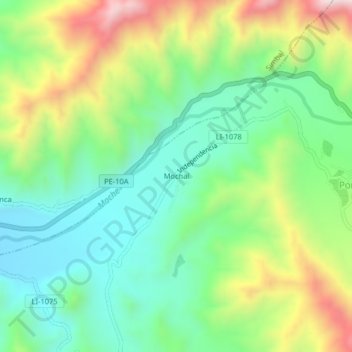
Name: Mochal topographic map, elevation, terrain.
Location: Mochal, Poroto, Trujillo, La Libertad, Perú (-8.03041 -78.80845 -7.99041 -78.76845)
Average elevation: 629 m
Minimum elevation: 399 m
Maximum elevation: 1,056 m
Thank you for supporting this site ❤️
Make a donation
Make a donation
Gear up for your next adventure:
As an Amazon Associate, this site earns from qualifying purchases at no extra cost to you.