
Lindell Beach topographic map
Click on the map to display elevation.
About this map
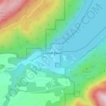
Name: Lindell Beach topographic map, elevation, terrain.
Average elevation: 268 m
Minimum elevation: 40 m
Maximum elevation: 943 m
Fraser Valley Regional District trails, hiking, mountain biking, running and outdoor activities
Other topographic maps
Click on a map to view its topography, its elevation and its terrain.
Cultus Lake
Canada > British Columbia > Fraser Valley Regional District > Area H (Cultus Lake/Columbia Valley) > Cultus Lake
Average elevation: 191 m