
Thank you for supporting this site ❤️
Make a donation
Make a donation
Gear up for your next adventure:
As an Amazon Associate, this site earns from qualifying purchases at no extra cost to you.
Purodi topographic map
Click on the map to display elevation.
Thank you for supporting this site ❤️
Make a donation
Make a donation
Gear up for your next adventure:
As an Amazon Associate, this site earns from qualifying purchases at no extra cost to you.
About this map
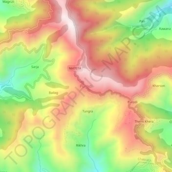
Name: Purodi topographic map, elevation, terrain.
Location: Purodi, Chakrata, Dehradun, Uttarakhand, 248196, India (30.64559 77.86346 30.68559 77.90346)
Average elevation: 1,829 m
Minimum elevation: 1,410 m
Maximum elevation: 2,188 m
Thank you for supporting this site ❤️
Make a donation
Make a donation
Gear up for your next adventure:
As an Amazon Associate, this site earns from qualifying purchases at no extra cost to you.