
Thank you for supporting this site ❤️
Make a donation
Make a donation
Gear up for your next adventure:
As an Amazon Associate, this site earns from qualifying purchases at no extra cost to you.
Nongkhiao-Tai topographic map
Click on the map to display elevation.
Thank you for supporting this site ❤️
Make a donation
Make a donation
Gear up for your next adventure:
As an Amazon Associate, this site earns from qualifying purchases at no extra cost to you.
About this map
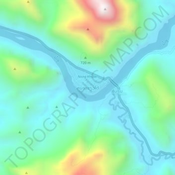
Name: Nongkhiao-Tai topographic map, elevation, terrain.
Location: Nongkhiao-Tai, Ngoy District, Luang Prabang, 06050, Laos (20.54978 102.58969 20.58978 102.62969)
Average elevation: 585 m
Minimum elevation: 315 m
Maximum elevation: 1,480 m
Thank you for supporting this site ❤️
Make a donation
Make a donation
Gear up for your next adventure:
As an Amazon Associate, this site earns from qualifying purchases at no extra cost to you.