
Thank you for supporting this site ❤️
Make a donation
Make a donation
Gear up for your next adventure:
As an Amazon Associate, this site earns from qualifying purchases at no extra cost to you.
Suelves topographic map
Click on the map to display elevation.
Thank you for supporting this site ❤️
Make a donation
Make a donation
Gear up for your next adventure:
As an Amazon Associate, this site earns from qualifying purchases at no extra cost to you.
About this map
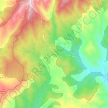
Name: Suelves topographic map, elevation, terrain.
Location: Suelves, Bárcabo, Sobrarbe, Huesca, Aragón, Spanje (42.19593 0.08818 42.23593 0.12818)
Average elevation: 806 m
Minimum elevation: 616 m
Maximum elevation: 1,014 m
Thank you for supporting this site ❤️
Make a donation
Make a donation
Gear up for your next adventure:
As an Amazon Associate, this site earns from qualifying purchases at no extra cost to you.