
Moyock topographic map
Interactive map
Click on the map to display elevation.
About this map
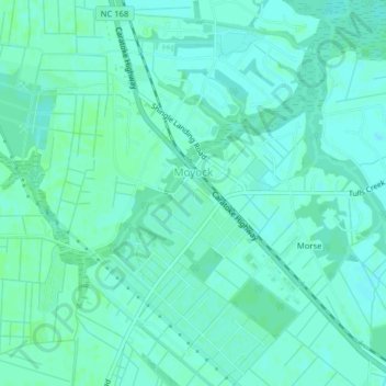
Name: Moyock topographic map, elevation, terrain.
Location: Moyock, Currituck County, North Carolina, United States (36.50690 -76.19037 36.53878 -76.15680)
Average elevation: 3 m
Minimum elevation: 0 m
Maximum elevation: 7 m
Other topographic maps
Click on a map to view its topography, its elevation and its terrain.
Corolla
United States > North Carolina > Currituck County
Corolla, Currituck County, North Carolina, 27927, United States
Average elevation: 0 m
Corolla
United States > North Carolina > Currituck County
Corolla, Currituck County, North Carolina, 27927, United States
Average elevation: 0 m
Grandy
United States > North Carolina > Currituck County
Grandy, Currituck County, North Carolina, 27939, United States
Average elevation: 2 m
Barco
United States > North Carolina > Currituck County
Barco, Currituck County, North Carolina, 27917, United States
Average elevation: 1 m
Aydlett
United States > North Carolina > Currituck County
Aydlett, Currituck County, North Carolina, 27916, United States
Average elevation: 2 m
Cedar Island
United States > North Carolina > Currituck County
Cedar Island, Currituck County, North Carolina, United States
Average elevation: 0 m
Moyock
United States > North Carolina > Currituck County
Moyock, Currituck County, North Carolina, United States
Average elevation: 3 m
Currituck
United States > North Carolina > Currituck County > Currituck
Currituck, Currituck County, North Carolina, 27929, United States
Average elevation: 2 m
Man Island
United States > North Carolina > Currituck County
Man Island, Currituck County, North Carolina, United States
Average elevation: 2 m