Geolocate

Kanpar topographic map

Click on the map to display elevation.

About this map

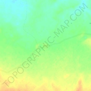
Name: Kanpar topographic map, elevation, terrain.

Location: Kanpar, Rapar Taluka, Kachchh, Gujarat, 370155, India (23.57084 70.76902 23.61084 70.80902)

Average elevation: 60 m

Minimum elevation: 44 m

Maximum elevation: 77 m

Other topographic maps

Click on a map to view its topography, its elevation and its terrain.

Chitrod

India > Gujarat > Rapar Taluka

Average elevation: 110 m

Rapar

India > Gujarat > Rapar Taluka

Average elevation: 66 m

Gear up for your next adventure:

🧥Thermal Layer - Insulating layer for cold outdoor conditions
🧴First Aid Kit - Essential first aid supplies for outdoor emergencies
Tent Footprint - Protect tent floor and increase durability
🧴Outdoor Sunscreen - High SPF protection for high-altitude UV exposure
🧤Thermal Hiking Gloves - Grip-enhanced gloves for cold-weather altitude trekking

As an Amazon Associate, this site earns from qualifying purchases at no extra cost to you.