
Make a donation
Gear up for your next adventure:
As an Amazon Associate, this site earns from qualifying purchases at no extra cost to you.
Pakala topographic map
Click on the map to display elevation.
Make a donation
Gear up for your next adventure:
As an Amazon Associate, this site earns from qualifying purchases at no extra cost to you.
Pakala
Pakala consists of 180 villages and 28 panchayats. Nagamma Agraharam is the smallest village and Pakala is the biggest village. It is in the 371 m elevation (altitude).
Make a donation
Gear up for your next adventure:
As an Amazon Associate, this site earns from qualifying purchases at no extra cost to you.
About this map
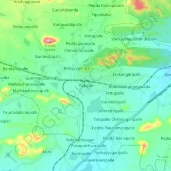
Name: Pakala topographic map, elevation, terrain.
Location: Pakala, Tirupati, Andhra Pradesh, 517112, India (13.40905 79.07489 13.48905 79.15489)
Average elevation: 384 m
Minimum elevation: 329 m
Maximum elevation: 570 m
Make a donation
Gear up for your next adventure:
As an Amazon Associate, this site earns from qualifying purchases at no extra cost to you.