Geolocate

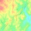
Franklinville topographic map

Click on the map to display elevation.

About this map
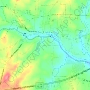
Name: Franklinville topographic map, elevation, terrain.

Location: Franklinville, Randolph County, North Carolina, United States (35.72498 -79.70806 35.75475 -79.67056)

Average elevation: 163 m

Minimum elevation: 133 m

Maximum elevation: 211 m

Other topographic maps

Click on a map to view its topography, its elevation and its terrain.
Sophia

United States > North Carolina > Randolph County

Average elevation: 227 m

Ulah

United States > North Carolina > Randolph County

Average elevation: 237 m

Gear up for your next adventure:

🩹Moleskin Blister Pads - Direct protection for painful foot pressure points
🧢Outdoor Visor - Breathable visor for sunny hikes
🔋Lithium AA Batteries - Long-lasting power that performs in extreme cold
💧Filtered Water Bottle - Safe drinking water on the go
🎒Hiking Backpack - Lightweight and ergonomic backpacks for day hikes or multi-day treks

As an Amazon Associate, this site earns from qualifying purchases at no extra cost to you.