Geolocate

Bacan Island topographic map

Click on the map to display elevation.

About this map
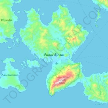
Name: Bacan Island topographic map, elevation, terrain.

Location: Bacan Island, Halmahera Selatan, North Maluku, Maluku, 97791, Indonesia (-0.87038 127.29147 -0.30009 127.90602)

Average elevation: 127 m

Minimum elevation: -2 m

Maximum elevation: 2,057 m

Other topographic maps

Click on a map to view its topography, its elevation and its terrain.

Mandaong

Indonesia > North Maluku > Halmahera Selatan

Average elevation: 29 m

Gear up for your next adventure:

🔋Lithium AA Batteries - Long-lasting power that performs in extreme cold
🥾Hiking Shoes - Durable and comfortable shoes for trail hiking
💡LED Headlamp - Hands-free illumination for night hiking and camping
🧭GPS Handheld Device - Reliable GPS navigation for outdoor adventures
🥾Trail Hiking Socks - Comfortable socks to prevent blisters and fatigue

As an Amazon Associate, this site earns from qualifying purchases at no extra cost to you.