Battenberg (Pfalz) topographic map
Interactive map
Click on the map to display elevation.
About this map
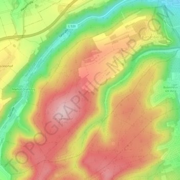
Name: Battenberg (Pfalz) topographic map, elevation, terrain.
Average elevation: 305 m
Minimum elevation: 170 m
Maximum elevation: 414 m

Click on the map to display elevation.
Name: Battenberg (Pfalz) topographic map, elevation, terrain.
Average elevation: 305 m
Minimum elevation: 170 m
Maximum elevation: 414 m