
St. Paul's Island topographic map
Interactive map
Click on the map to display elevation.
About this map
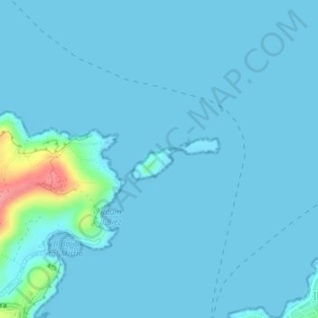
Name: St. Paul's Island topographic map, elevation, terrain.
Location: St. Paul's Island, Mellieha, Northern Region, Malta (35.96395 14.39855 35.96744 14.40774)
Average elevation: 6 m
Minimum elevation: 0 m
Maximum elevation: 90 m