Geolocate

Katekalyan topographic map

Click on the map to display elevation.

About this map

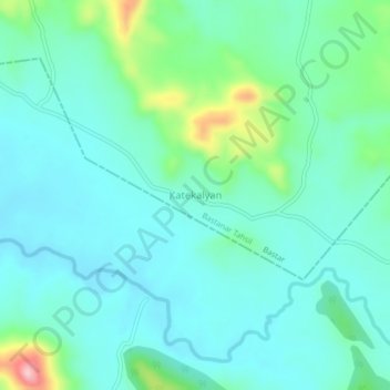
Name: Katekalyan topographic map, elevation, terrain.

Location: Katekalyan, Bastanar Tahsil, Bastar, Chhattisgarh, India (18.78075 81.62232 18.82075 81.66232)

Average elevation: 595 m

Minimum elevation: 553 m

Maximum elevation: 756 m

Gear up for your next adventure:

🧣Evaporative Cooling Towel - Beat the heat during intense summer climbs
👟Leg Gaiters - Keep debris, mud, and snow out of your boots
🔭Compact Binoculars - Lightweight optics for scouting trails and wildlife
Lightweight Backpacking Tent - Compact tent for efficient hiking trips
🥾Hiking Leggings - Comfortable leggings for outdoor activities

As an Amazon Associate, this site earns from qualifying purchases at no extra cost to you.