
Thank you for supporting this site ❤️
Make a donation
Make a donation
Gear up for your next adventure:
As an Amazon Associate, this site earns from qualifying purchases at no extra cost to you.
Waad topographic map
Click on the map to display elevation.
Thank you for supporting this site ❤️
Make a donation
Make a donation
Gear up for your next adventure:
As an Amazon Associate, this site earns from qualifying purchases at no extra cost to you.
About this map
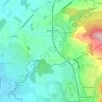
Name: Waad topographic map, elevation, terrain.
Location: Waad, Bettwiesen, Bezirk Münchwilen, Thurgau, 9553, Switzerland (47.48241 9.01022 47.50241 9.03022)
Average elevation: 555 m
Minimum elevation: 503 m
Maximum elevation: 701 m
Thank you for supporting this site ❤️
Make a donation
Make a donation
Gear up for your next adventure:
As an Amazon Associate, this site earns from qualifying purchases at no extra cost to you.