Geolocate

Pasupala topographic map

Click on the map to display elevation.

About this map

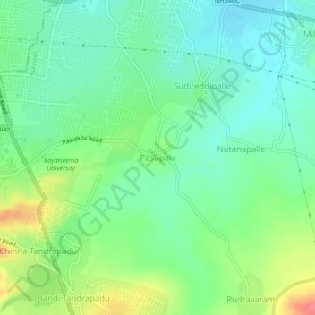
Name: Pasupala topographic map, elevation, terrain.

Location: Pasupala, Kurnool, Andhra Pradesh, 518008, India (15.75546 78.05632 15.79546 78.09632)

Average elevation: 299 m

Minimum elevation: 277 m

Maximum elevation: 342 m

Gear up for your next adventure:

🔋Lithium AA Batteries - Long-lasting power that performs in extreme cold
🔦UV Flashlight - Detect minerals or specific insects in the dark
🧢Hiking Sun Hat - Wide-brimmed protection for exposed mountain ridges
🧴Sunscreen SPF - Broad-spectrum sunscreen for outdoor activities
🧤Rechargeable Heated Gloves - Extreme warmth for Canadian winter expeditions

As an Amazon Associate, this site earns from qualifying purchases at no extra cost to you.