Geolocate

Gelsenkirchen topographic map

Click on the map to display elevation.

About this map

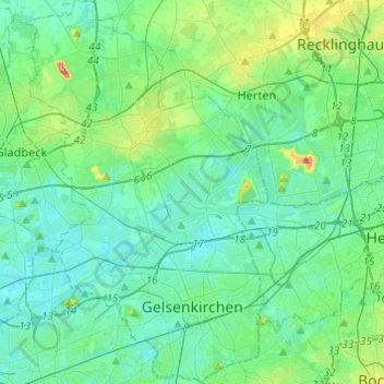
Name: Gelsenkirchen topographic map, elevation, terrain.

Location: Gelsenkirchen, North Rhine-Westphalia, Germany (51.48080 6.98750 51.63159 7.15234)

Average elevation: 57 m

Minimum elevation: 27 m

Maximum elevation: 197 m

Other topographic maps

Click on a map to view its topography, its elevation and its terrain.

Gear up for your next adventure:

🏕️Camping Hammock - Integrated protection for sleeping between trees
🩹Moleskin Blister Pads - Direct protection for painful foot pressure points
🥾Trekking Poles - Adjustable trekking poles to reduce knee stress and improve stability
👟Trail Running Shoes - Agile footwear for fast-paced topographic exploration
🧦Outdoor Socks - Durable socks designed for hiking and outdoor sports

As an Amazon Associate, this site earns from qualifying purchases at no extra cost to you.