Geolocate

Courtney Place topographic map

Click on the map to display elevation.

About this map
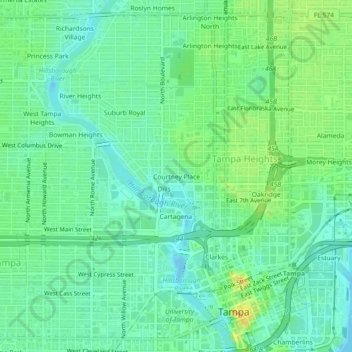
Name: Courtney Place topographic map, elevation, terrain.

Location: Courtney Place, Tampa, Hillsborough County, Florida, 33605, United States (27.94311 -82.48580 27.98311 -82.44580)

Average elevation: 13 m

Minimum elevation: -6 m

Maximum elevation: 37 m

Other topographic maps

Click on a map to view its topography, its elevation and its terrain.
Gear up for your next adventure:

🧢Sun Hat - Wide-brim hat for sun protection
💡Portable Camping Lamp - Rechargeable lamp for campsite lighting
🧴Bear Spray Holster - Quick-access carry for essential Canadian wilderness safety
🔪Outdoor Multitool - Versatile tool for repairs and food prep in the wild
🗺️Topographic Maps - Detailed maps to explore trails, mountains, and wilderness areas

As an Amazon Associate, this site earns from qualifying purchases at no extra cost to you.