
Thank you for supporting this site ❤️
Make a donation
Make a donation
Gear up for your next adventure:
As an Amazon Associate, this site earns from qualifying purchases at no extra cost to you.
Thumel topographic map
Click on the map to display elevation.
Thank you for supporting this site ❤️
Make a donation
Make a donation
Gear up for your next adventure:
As an Amazon Associate, this site earns from qualifying purchases at no extra cost to you.
About this map
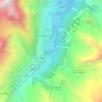
Name: Thumel topographic map, elevation, terrain.
Location: Thumel, Rhêmes-Notre-Dame, Valle d'Aosta, Italia (45.51813 7.08281 45.55813 7.12281)
Average elevation: 2,425 m
Minimum elevation: 1,809 m
Maximum elevation: 3,559 m
Thank you for supporting this site ❤️
Make a donation
Make a donation
Gear up for your next adventure:
As an Amazon Associate, this site earns from qualifying purchases at no extra cost to you.