Geolocate

Vivian topographic map

Click on the map to display elevation.

About this map

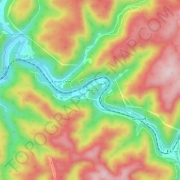
Name: Vivian topographic map, elevation, terrain.

Location: Vivian, McDowell County, West Virginia, 24853, United States (37.39817 -81.50733 37.43817 -81.46733)

Average elevation: 619 m

Minimum elevation: 441 m

Maximum elevation: 787 m

Other topographic maps

Click on a map to view its topography, its elevation and its terrain.

Welch

United States > West Virginia > McDowell County

Average elevation: 548 m

Gear up for your next adventure:

💡LED Headlamp - Hands-free illumination for night hiking and camping
🗺️Topographic Maps - Detailed maps to explore trails, mountains, and wilderness areas
🧥Waterproof Pants - Keep dry during rainy hiking conditions
🛶Kayak Accessories - Essential gear for safe and fun kayaking adventures
🧴Outdoor Sunscreen - High SPF protection for high-altitude UV exposure

As an Amazon Associate, this site earns from qualifying purchases at no extra cost to you.