Geolocate

Tambo Colorado topographic map

Click on the map to display elevation.

About this map

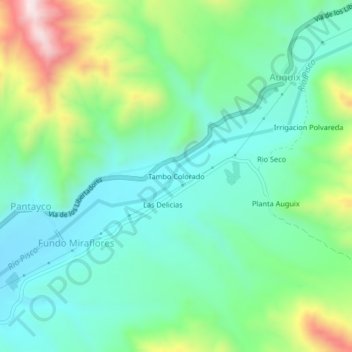
Name: Tambo Colorado topographic map, elevation, terrain.

Location: Tambo Colorado, Fundo Miraflores, Humay, Pisco, Ica, Perú (-13.72631 -75.84529 -13.68631 -75.80529)

Average elevation: 609 m

Minimum elevation: 448 m

Maximum elevation: 1,016 m

Gear up for your next adventure:

🦶Hiking Shoe Insoles - Added support for high arches and long days on feet
📷Outdoor Action Camera - Capture high-elevation views and rugged adventures
Lightweight Backpacking Tent - Compact tent for efficient hiking trips
🥾Light Trekking Boots - Supportive boots for multi-day treks
🛌Down Sleeping Bag - Superior warmth-to-weight ratio for cold nights

As an Amazon Associate, this site earns from qualifying purchases at no extra cost to you.