Geolocate

Tarapoto topographic map

Click on the map to display elevation.

About this map

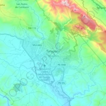
Name: Tarapoto topographic map, elevation, terrain.

Location: Tarapoto, Province of San Martín, San Martín, Peru (-6.56879 -76.40972 -6.41253 -76.33334)

Average elevation: 464 m

Minimum elevation: 206 m

Maximum elevation: 1,619 m

Gear up for your next adventure:

🚲Bike Repair Kit - Essential tools for on-trail mechanical issues
🥤Collapsible Travel Cup - Saves space and weight in your mess kit
🥾Hiking Leggings - Comfortable leggings for outdoor activities
🥾Trail Hiking Shoes - Durable shoes designed for rugged trails
🦌Outdoor Trail Camera - Monitor wildlife activity near your favorite spots

As an Amazon Associate, this site earns from qualifying purchases at no extra cost to you.