Geolocate

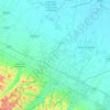
Sassoleone topographic map

Click on the map to display elevation.

About this map

Name: Sassoleone topographic map, elevation, terrain.

Location: Sassoleone, Casalfiumanese, Nuovo Circondario Imolese, Bologna, Emilia-Romagna, 40020, Italy (44.25898 11.47755 44.26664 11.48853)

Average elevation: 382 m

Minimum elevation: 264 m

Maximum elevation: 574 m

Other topographic maps

Click on a map to view its topography, its elevation and its terrain.
Bologna

Italy > Emilia-Romagna > Bologna

Bologna is situated on the edge of the Po Plain at the foot of the Apennine Mountains, at the meeting of the Reno and Savena river valleys. As Bologna's two main watercourses flow directly to the sea, the town lies outside of the drainage basin of the River Po. The Province of Bologna stretches from the…

Average elevation: 91 m

Case Selvatiche

Italy > Emilia-Romagna > Bologna > Imola > Bicocca Nuova

Average elevation: 22 m

Querciola

Italy > Emilia-Romagna > Bologna

Average elevation: 760 m

Bologna

Italy > Emilia-Romagna > Bologna

Bologna is situated on the edge of the Po Plain at the foot of the Apennine Mountains, at the meeting of the Reno and Savena river valleys. As Bologna's two main watercourses flow directly to the sea, the town lies outside of the drainage basin of the River Po. The province of Bologna stretches from the…

Average elevation: 91 m

Bologna

Italy > Emilia-Romagna > Bologna

Bologna is situated on the edge of the Po Plain at the foot of the Apennine Mountains, at the meeting of the Reno and Savena river valleys. As Bologna's two main watercourses flow directly to the sea, the town lies outside of the drainage basin of the River Po. The Province of Bologna stretches from the…

Average elevation: 91 m

Valsamoggia

Italy > Emilia-Romagna > Bologna

Average elevation: 278 m

Anzola dell'Emilia

Italy > Emilia-Romagna > Bologna

Average elevation: 34 m

Burzanella

Italy > Emilia-Romagna > Bologna

Average elevation: 661 m

Castel del Rio

Italy > Emilia-Romagna > Bologna

Average elevation: 480 m

Porretta Terme

Italy > Emilia-Romagna > Bologna > Alto Reno Terme

Average elevation: 479 m

Gessi

Italy > Emilia-Romagna > Bologna > Zola Predosa

Average elevation: 166 m

Settefonti

Italy > Emilia-Romagna > Bologna > Ozzano dell'Emilia

Average elevation: 233 m

Sasso Marconi

Italy > Emilia-Romagna > Bologna

Average elevation: 261 m

Montebudello

Italy > Emilia-Romagna > Bologna > Valsamoggia

Average elevation: 164 m

San Lazzaro di Savena

Italy > Emilia-Romagna > Bologna

Average elevation: 124 m

Frassineta

Italy > Emilia-Romagna > Bologna

Average elevation: 696 m

Zappolino

Italy > Emilia-Romagna > Bologna > Valsamoggia

Average elevation: 210 m

Tolara

Italy > Emilia-Romagna > Bologna > Ozzano dell'Emilia

Average elevation: 67 m

Tolè

Italy > Emilia-Romagna > Bologna

Average elevation: 665 m

Funo di Argelato

Italy > Emilia-Romagna > Bologna

Average elevation: 24 m

Monte Donato

Italy > Emilia-Romagna > Bologna > Bologna

Average elevation: 181 m

Miravalle

Italy > Emilia-Romagna > Bologna > Molinella

Average elevation: 10 m

Bologna

Italy > Emilia-Romagna > Bologna

Bologna is situated on the edge of the Po Plain at the foot of the Apennine Mountains, at the meeting of the Reno and Savena river valleys. As Bologna's two main watercourses flow directly to the sea, the town lies outside of the drainage basin of the River Po. The province of Bologna stretches from the…

Average elevation: 91 m

Imola

Italy > Emilia-Romagna > Bologna

Average elevation: 49 m

Tossignano

Italy > Emilia-Romagna > Bologna

Average elevation: 193 m

Loiano

Italy > Emilia-Romagna > Bologna

Average elevation: 485 m

Savigno

Italy > Emilia-Romagna > Bologna > Valsamoggia

Average elevation: 535 m

Carviano

Italy > Emilia-Romagna > Bologna

Average elevation: 365 m

Fabbrica

Italy > Emilia-Romagna > Bologna > Imola

Average elevation: 115 m

Castello d'Argile

Italy > Emilia-Romagna > Bologna

Average elevation: 19 m

Monzuno

Italy > Emilia-Romagna > Bologna

Average elevation: 454 m

Gaggio Montano

Italy > Emilia-Romagna > Bologna

Average elevation: 679 m

San Pietro in Casale

Italy > Emilia-Romagna > Bologna

Average elevation: 13 m

Imola

Italy > Emilia-Romagna > Bologna

Average elevation: 49 m

Camugnano

Italy > Emilia-Romagna > Bologna

Average elevation: 680 m

Monghidoro

Italy > Emilia-Romagna > Bologna

The territory surrounding the municipality is, for the largest part, mountainous with elevations ranging between a minimum of 400 metres (1,300 ft) above sea level to the north-east to a maximum of 1,290 metres (4,230 ft) on its southern flank.

Average elevation: 732 m

Crocetta

Italy > Emilia-Romagna > Bologna > Medicina

Average elevation: 20 m

Serraglio

Italy > Emilia-Romagna > Bologna > Fiumetto

Average elevation: 380 m

Medicina

Italy > Emilia-Romagna > Bologna

Average elevation: 17 m

Molino della Pergola

Italy > Emilia-Romagna > Bologna > Campeggio

Average elevation: 620 m

Castel San Pietro Terme

Italy > Emilia-Romagna > Bologna

Average elevation: 113 m

Chiusura

Italy > Emilia-Romagna > Bologna > Imola

Average elevation: 31 m

Imola

Italy > Emilia-Romagna > Bologna

Average elevation: 49 m

Calvenzano

Italy > Emilia-Romagna > Bologna

Average elevation: 366 m

Boricelle

Italy > Emilia-Romagna > Bologna > Rocca di Roffeno

Average elevation: 728 m

Fiumetto

Italy > Emilia-Romagna > Bologna

Average elevation: 374 m

Bologna

Italy > Emilia-Romagna > Bologna

Bologna is situated on the edge of the Po Plain at the foot of the Apennine Mountains, at the meeting of the Reno and Savena river valleys. As Bologna's two main watercourses flow directly to the sea, the town lies outside of the drainage basin of the River Po. The Province of Bologna stretches from the…

Average elevation: 91 m

Calcara

Italy > Emilia-Romagna > Bologna > Valsamoggia

Average elevation: 48 m

Rivabella

Italy > Emilia-Romagna > Bologna > Zola Predosa

Average elevation: 176 m

Ca' dei Marchi

Italy > Emilia-Romagna > Bologna > Valsamoggia > Savigno

Average elevation: 551 m

Sabbiuno di Montagna

Italy > Emilia-Romagna > Bologna > Bologna

Average elevation: 210 m

Vergato

Italy > Emilia-Romagna > Bologna

Average elevation: 467 m

Gear up for your next adventure:

🗺️Topographic Maps - Detailed maps to explore trails, mountains, and wilderness areas
🧢Hiking Hat - Sun-protective and breathable hats for long treks
💡LED Headlamp - Hands-free illumination for night hiking and camping
🧥Waterproof Hiking Jacket - Protect yourself from rain and wind while hiking
🥾Approach Shoes - Shoes designed for climbing approaches and rugged trails

As an Amazon Associate, this site earns from qualifying purchases at no extra cost to you.