
Thank you for supporting this site ❤️
Make a donation
Make a donation
Gear up for your next adventure:
As an Amazon Associate, this site earns from qualifying purchases at no extra cost to you.
Àreu topographic map
Click on the map to display elevation.
Thank you for supporting this site ❤️
Make a donation
Make a donation
Gear up for your next adventure:
As an Amazon Associate, this site earns from qualifying purchases at no extra cost to you.
About this map
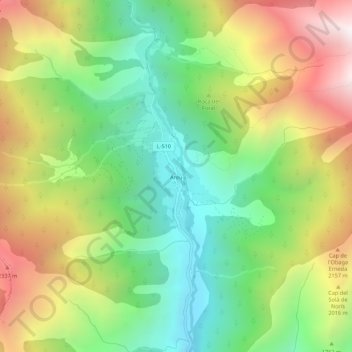
Name: Àreu topographic map, elevation, terrain.
Location: Àreu, Alins, Pallars Sobirá, Lérida, Cataluña, 25574, España (42.56851 1.30658 42.60851 1.34658)
Average elevation: 1,746 m
Minimum elevation: 1,141 m
Maximum elevation: 2,607 m
Thank you for supporting this site ❤️
Make a donation
Make a donation
Gear up for your next adventure:
As an Amazon Associate, this site earns from qualifying purchases at no extra cost to you.