Geolocate

Leiderdorp topographic map

Click on the map to display elevation.

About this map
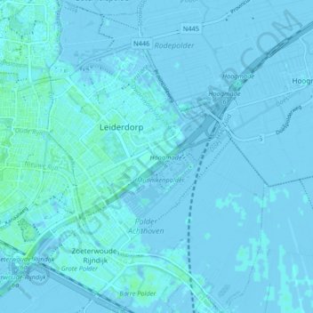
Name: Leiderdorp topographic map, elevation, terrain.

Location: Leiderdorp, South Holland, Netherlands (52.13190 4.51469 52.18212 4.57148)

Average elevation: 0 m

Minimum elevation: -4 m

Maximum elevation: 5 m

Gear up for your next adventure:

🔋Emergency Crank Radio - Weather alerts and power without needing batteries
🛶Canoe Life Vest - Safety vest for water sports
💡Solar Camping Lamp - Eco-friendly lighting for campsites
🥾Light Hiking Boots - Lightweight and comfortable boots for day hikes
⛺Camping Tent - Weather-resistant tents suitable for 2 to 6 people

As an Amazon Associate, this site earns from qualifying purchases at no extra cost to you.