Geolocate

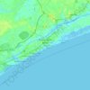
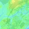
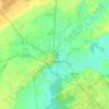
Wampee topographic map

Click on the map to display elevation.

About this map

Name: Wampee topographic map, elevation, terrain.

Location: Wampee, Horry County, South Carolina, 29568, United States (33.84045 -78.75418 33.88045 -78.71418)

Average elevation: 6 m

Minimum elevation: 1 m

Maximum elevation: 12 m

Other topographic maps

Click on a map to view its topography, its elevation and its terrain.
Myrtle Beach

United States > South Carolina > Horry County

Myrtle Beach features a predominantly flat topography characterized by its coastal plain setting. The area is situated just a few feet above sea level, with an average elevation of approximately 20 feet (6 meters), making it ideal for expansive sandy beaches and shallow tidal estuaries. The region is part of a…

Average elevation: 6 m
Conway

United States > South Carolina > Horry County

Average elevation: 10 m

Loris

United States > South Carolina > Horry County

Average elevation: 31 m

Aynor

United States > South Carolina > Horry County

Average elevation: 27 m

Aynor

United States > South Carolina > Horry County

Average elevation: 27 m

Conway

United States > South Carolina > Horry County

Average elevation: 10 m

Conway

United States > South Carolina > Horry County

Average elevation: 10 m

Gear up for your next adventure:

🧭GPS Tracker - Track your location in remote areas safely
🚑Survival Whistle - Signal for help across long distances in mountains
❄️Traction Ice Cleats - Slip-on spikes for icy trails and winter hiking
🎒Hiking Daypack - Lightweight and durable backpacks for day trips and excursions
🥾Lightweight Hiking Shoes - Comfortable shoes for day hikes

As an Amazon Associate, this site earns from qualifying purchases at no extra cost to you.