
Itbayat topographic map
Interactive map
Click on the map to display elevation.
About this map
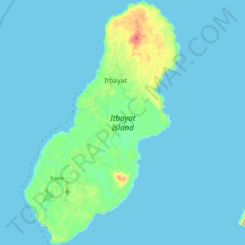
Name: Itbayat topographic map, elevation, terrain.
Location: Itbayat, Batanes, Cagayan Valley, 3905, Philippinen (20.68807 121.78239 20.83631 121.88359)
Average elevation: 31 m
Minimum elevation: 0 m
Maximum elevation: 332 m