Geolocate

Springfield topographic map

Click on the map to display elevation.

About this map

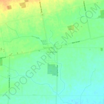
Name: Springfield topographic map, elevation, terrain.

Location: Springfield, Elgin County, Southwestern Ontario, Ontario, N0L 2J0, Canada (42.80802 -80.95394 42.84802 -80.91394)

Average elevation: 244 m

Minimum elevation: 230 m

Maximum elevation: 266 m

Elgin County trails, hiking, mountain biking, running and outdoor activities

Other topographic maps

Click on a map to view its topography, its elevation and its terrain.

Central Elgin

Canada > Ontario > Elgin County

Average elevation: 234 m

Central Elgin

Canada > Ontario > Elgin County

Average elevation: 234 m

Southwold

Canada > Ontario > Elgin County

Average elevation: 221 m

Aylmer

Canada > Ontario > Elgin County

Average elevation: 231 m

Dunwich

Canada > Ontario > Elgin County > Dutton/Dunwich

Average elevation: 208 m

Gear up for your next adventure:

🥾Trekking Poles - Adjustable trekking poles to reduce knee stress and improve stability
🥾Waterproof Trail Shoes - Shoes designed to handle wet terrain
💡Solar Camping Lamp - Eco-friendly lighting for campsites
🚑Survival Whistle - Signal for help across long distances in mountains
💡Compact LED Flashlight - Powerful and portable flashlight for outdoor use

As an Amazon Associate, this site earns from qualifying purchases at no extra cost to you.