Geolocate

Enzai topographic map

Click on the map to display elevation.

About this map
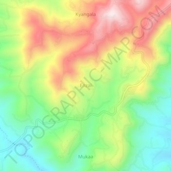
Name: Enzai topographic map, elevation, terrain.

Location: Enzai, Mukaa ward, Kilome, Makueni, Kenya (-1.85330 37.29660 -1.81330 37.33660)

Average elevation: 1,661 m

Minimum elevation: 1,439 m

Maximum elevation: 1,938 m

Gear up for your next adventure:

🔦LED Headlamp - Hands-free lighting for early morning starts or late finishes
🧥Waterproof Jacket - Lightweight rain jackets for hiking and outdoor activities
🔭Compact Binoculars - Lightweight optics for scouting trails and wildlife
🥾Approach Boots - Comfortable boots for hiking and climbing approaches
🧥Ultralight Puffy Jacket - Maximum warmth that packs down to the size of an orange

As an Amazon Associate, this site earns from qualifying purchases at no extra cost to you.