Geolocate

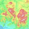
Grottaminarda topographic map

Click on the map to display elevation.

About this map

Name: Grottaminarda topographic map, elevation, terrain.

Location: Grottaminarda, Terre dell’Ufita, Avellino, Campania, 83035, Italy (41.03153 15.01191 41.10314 15.10659)

Average elevation: 432 m

Minimum elevation: 221 m

Maximum elevation: 683 m

Other topographic maps

Click on a map to view its topography, its elevation and its terrain.

Pizzo d'Alvano

Italy > Campania > Avellino > Quindici

Average elevation: 763 m

Quaglietta

Italy > Campania > Avellino > Calabritto

Average elevation: 320 m

Santa Barbara

Italy > Campania > Avellino > Ariano Irpino

Average elevation: 461 m

Ariano Scalo

Italy > Campania > Avellino > Ariano Irpino

Average elevation: 576 m

Gear up for your next adventure:

🧢Beanie Hat - Keep your head warm in cold weather
🧼Travel Hand Sanitizer - Keep hands clean when water is scarce
🦶Hiking Shoe Insoles - Added support for high arches and long days on feet
🛶Canoe Life Vest - Safety vest for water sports
🧤Thermal Hiking Gloves - Grip-enhanced gloves for cold-weather altitude trekking

As an Amazon Associate, this site earns from qualifying purchases at no extra cost to you.