Geolocate

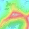
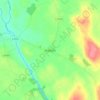
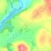
Pollerton Little topographic map

Click on the map to display elevation.

About this map

Name: Pollerton Little topographic map, elevation, terrain.

Location: Pollerton Little, Carlow Rural ED, The Municipal District of Carlow, County Carlow, Leinster, Ireland (52.84619 -6.90526 52.85690 -6.87496)

Average elevation: 73 m

Minimum elevation: 54 m

Maximum elevation: 101 m

Other topographic maps

Click on a map to view its topography, its elevation and its terrain.
Greenoge

Ireland > County Carlow

Average elevation: 272 m

Slievebawn

Ireland > County Carlow

Average elevation: 315 m

Tinryland

Ireland > County Carlow

Average elevation: 72 m

Ardattin

Ireland > County Carlow

Average elevation: 83 m

Blackstairs Mountain

Ireland > County Carlow

Average elevation: 429 m

Borris

Ireland > County Carlow

Average elevation: 60 m

Coolnamara Cross Roads

Ireland > County Carlow

Average elevation: 65 m

Borris

Ireland > County Carlow

Average elevation: 60 m

Borris

Ireland > County Carlow

Average elevation: 60 m

Gear up for your next adventure:

💡Solar Camping Lamp - Eco-friendly lighting for campsites
🔦LED Headlamp - Hands-free lighting for early morning starts or late finishes
🦶Anti-Blister Balm - Prevents friction and hotspots during long ascents
🧦Hiking Liner Socks - Thin base layer to prevent friction and blisters
🚲Handlebar Phone Mount - View topographic-map.com live while cycling

As an Amazon Associate, this site earns from qualifying purchases at no extra cost to you.