Geolocate

El Roble topographic map

Click on the map to display elevation.

About this map

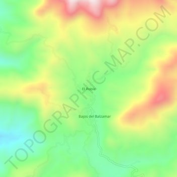
Name: El Roble topographic map, elevation, terrain.

Location: El Roble, Técpan de Galeana, Guerrero, Mexico (17.57917 -100.81833 17.61917 -100.77833)

Average elevation: 1,094 m

Minimum elevation: 807 m

Maximum elevation: 1,486 m

Gear up for your next adventure:

💡Compact LED Flashlight - Powerful and portable flashlight for outdoor use
🧴Insect Repellent - Protect yourself from bugs during outdoor adventures
🔋Solar Power Bank - Keep your GPS and devices charged during long outdoor trips
💧Hydration Pack - Hands-free hydration system for long hikes
🔨Vehicle Emergency Tool - Safety tool for remote road trips to trailheads

As an Amazon Associate, this site earns from qualifying purchases at no extra cost to you.