Geolocate

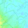
Pawili topographic map

Click on the map to display elevation.

About this map

Name: Pawili topographic map, elevation, terrain.

Location: Pawili, Bula, Camarines Sur, Bicol Region, 4430, Philippines (13.50412 123.27424 13.54412 123.31424)

Average elevation: 22 m

Minimum elevation: 10 m

Maximum elevation: 52 m

Other topographic maps

Click on a map to view its topography, its elevation and its terrain.
Lake Baao

Philippines > Camarines Sur > Bula

Average elevation: 5 m

Bicol River

Philippines > Camarines Sur > Bula

Average elevation: 10 m

Bicol River

Philippines > Camarines Sur > Bula > San Jose

Average elevation: 16 m

Gear up for your next adventure:

🧰Emergency Multi-Tool - Compact multi-tool for outdoor survival
🛶Waterproof Dry Bags - Keep electronics and clothes dry during river crossings
🚲MTB Frame Bag - Carry tools and maps directly on your bicycle frame
🔦LED Headtorch - Bright and durable light for night activities
🦶Hiking Shoe Insoles - Added support for high arches and long days on feet

As an Amazon Associate, this site earns from qualifying purchases at no extra cost to you.