
Xã Hòa Tân topographic map
Interactive map
Click on the map to display elevation.
About this map
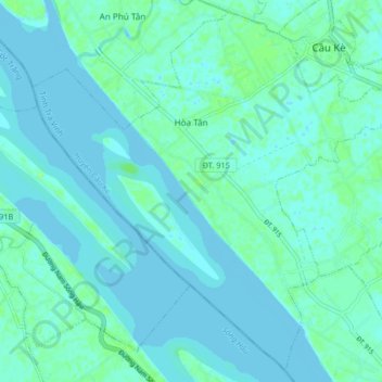
Name: Xã Hòa Tân topographic map, elevation, terrain.
Location: Xã Hòa Tân, Cầu Kè District, Trà Vinh Province, Vietnam (9.80241 105.99673 9.87860 106.07883)
Average elevation: 3 m
Minimum elevation: -3 m
Maximum elevation: 10 m