Geolocate

Enfield topographic map

Click on the map to display elevation.

About this map
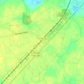
Name: Enfield topographic map, elevation, terrain.

Location: Enfield, Halifax County, North Carolina, United States (36.16849 -77.68014 36.19109 -77.65687)

Average elevation: 32 m

Minimum elevation: 19 m

Maximum elevation: 37 m

Other topographic maps

Click on a map to view its topography, its elevation and its terrain.
Gear up for your next adventure:

🧭GPS Outdoor Watch - Smart watch for navigation and fitness tracking in nature
🎒Fully Waterproof Backpack - Total protection for photography gear and electronics
🧥Waterproof Hiking Jacket - Protect yourself from rain and wind while hiking
🛰️Satellite Messenger - Emergency communication for areas with no cell service
🧦Hiking Liner Socks - Thin base layer to prevent friction and blisters

As an Amazon Associate, this site earns from qualifying purchases at no extra cost to you.