Geolocate

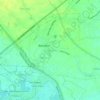
Maliwalu topographic map

Click on the map to display elevation.

About this map

Name: Maliwalu topographic map, elevation, terrain.

Location: Maliwalu, Bacolor, Pampanga, Central Luzon, 2001, Philippines (15.06023 120.55835 15.10223 120.63028)

Average elevation: 54 m

Minimum elevation: 21 m

Maximum elevation: 98 m

Other topographic maps

Click on a map to view its topography, its elevation and its terrain.

Talba

Philippines > Pampanga > Bacolor

Average elevation: 6 m

Parulog

Philippines > Pampanga > Bacolor

Average elevation: 12 m

San Antonio

Philippines > Pampanga > Bacolor

Average elevation: 18 m

Santa Ines

Philippines > Pampanga > Bacolor

Average elevation: 8 m

Potrero

Philippines > Pampanga > Bacolor

Average elevation: 38 m

Parulog

Philippines > Pampanga > Bacolor

Average elevation: 12 m

San Antonio

Philippines > Pampanga > Bacolor

Average elevation: 18 m

Santa Ines

Philippines > Pampanga > Bacolor

Average elevation: 8 m

Parulog

Philippines > Pampanga > Bacolor

Average elevation: 12 m

Gear up for your next adventure:

🎒Hiking Backpack - Lightweight and ergonomic backpacks for day hikes or multi-day treks
🧥Fleece Jacket - Warm and lightweight jacket for layering
🧤Insulated Winter Gloves - Heavy-duty protection for sub-zero Canadian adventures
💧Filtered Water Bottle - Safe drinking water on the go
🪑Insulated Seat Pad - Protect your seat from cold rocks and wet logs

As an Amazon Associate, this site earns from qualifying purchases at no extra cost to you.