Geolocate

Sutherlin topographic map

Click on the map to display elevation.

About this map

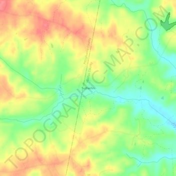
Name: Sutherlin topographic map, elevation, terrain.

Location: Sutherlin, Halifax County, Virginia, 24594, United States (36.60486 -79.21696 36.64486 -79.17696)

Average elevation: 142 m

Minimum elevation: 105 m

Maximum elevation: 176 m

Other topographic maps

Click on a map to view its topography, its elevation and its terrain.

Conner Lake

United States > Virginia > Halifax County

Average elevation: 130 m

Gear up for your next adventure:

🕶️Polarized Sunglasses - Reduces glare from snow and water at high elevations
Camping Essentials - All-in-one gear for a comfortable camping trip
🧦Thermal Socks - Warm socks for winter hiking or camping
🧥Packable Rain Jacket - Breathable waterproof layer for unpredictable weather
🧭Orienteering Kit - Tools for map reading and navigation in the wild

As an Amazon Associate, this site earns from qualifying purchases at no extra cost to you.