Geolocate

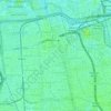
Ciracas topographic map

Click on the map to display elevation.

About this map

Name: Ciracas topographic map, elevation, terrain.

Location: Ciracas, East Jakarta, Special Capital Region of Jakarta, Indonesia (-6.37261 106.86257 -6.28699 106.89589)

Average elevation: 51 m

Minimum elevation: 21 m

Maximum elevation: 82 m

Other topographic maps

Click on a map to view its topography, its elevation and its terrain.

Gear up for your next adventure:

🧰Emergency Multi-Tool - Compact multi-tool for outdoor survival
🔥Camping Stove - Portable stoves to cook outdoors with ease
🚲Bike Repair Kit - Essential tools for on-trail mechanical issues
🧴Insect Repellent - Protect yourself from bugs during outdoor adventures
🌡️Emergency Mylar Blankets - Compact thermal protection for unexpected nights outdoors

As an Amazon Associate, this site earns from qualifying purchases at no extra cost to you.